Articles by Tracey

I like data and think it should be shared at not cost! Especially public data!

This GeoConnections webinar discussed the results of a Social Sciences and Humanities Research Council (SSHRC) Funded Partnership Development Grant entitled Mapping the Legal and Policy Boundaries of Digital Cartography led by Dr. R. Fraser Taylor of the Geomatics and Cartographic Research Centre (GCRC), Carleton University, and Dr. Teresa Scassa of the Faculty of Law, Centre of Law, Technology and Culture (CLTS) at the University of Ottawa, including the Canadian Internet Public Policy Interest Clinic (CIPPIC) and GeoConnections.

The issues presented were:

  • Traditional Knowledge (TK) and cybercartography;
  • The complexities of Intellectual Property rights and TK;
  • Challenges and possible solutions with regard to Western law and TK;
  • The role of collaborative relationships in cybercartography in the North.

(182 particiants, from all provinces and territories including Malawi, Italy, USA, New Zealand and the UK)

Ce webinaire de GéoConnexions a présenté les résultats d’une subvention de développement, en partenariat avec le Conseil de recherches en sciences humaines (CRSH) : « Mapping the Legal and Policy Boundaries of Digital Cartography », dirigée par Dr. R. Fraser Taylor du Geomatics and Cartographic Research Centre (GCRC) de l’Université de Carleton, et Dr. Teresa Scassa, du Centre de recherche en droit, technologie et société, de la faculté de droit de l’Université d’Ottawa, en collaboration avec la Clinique d’intérêt public et de politique d’internet du Canada (CIPPIC) et GéoConnexions.

Vous apprendrez davantage sur les sujets suivants :

  • Le savoir traditionnel et la cybercartographie;
  • Les complexités de la propriété intellectuelle et le savoir traditionnel;
  • Les défis et les solutions possibles en matière de droit occidental et de savoir traditionnel;
  • Le rôle des collaborations en cybercartographie dans les régions nordiques.

(37 participans, Territoires du nord ouest, Colombie Britanique, Alberta, Saskatchewan, Ontario, Quebec et Terre neuve aussi Belgique, Danemark, Etats-unies et Royaumes unies)

Jean-Noe Landry and Tracey P. Lauriault have an article entitled:

Les données ouvertes : la matière première du nouvel engagement citoyen

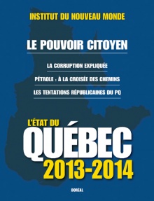
in this fantastic almanac type of publication produced yearly by L’institut du nouveau monde. The article features the unique type of open data movement in Quebec, which is a rich combination of  community development, grass roots engagement, technological activism and public policy making.  It is one of the few Canadian open data initiatives that really make data work to change public policy by embedding the work into a political process, while concurrently working within the political process to ensure evidence informed democratic deliberation and keeping government accountable.

etatduquebec

L’État du Québec est publié une fois l’an depuis 1995. Destiné au grand public, il fournit aux lecteurs l’ensemble des données factuelles utiles sur le Québec dans tous les domaines. On y trouve également le bilan politique, économique, culturel et social du Québec pour l’année écoulée ainsi que des textes d’analyse, produits par des spécialistes, sur tous les grands enjeux auxquels le Québec est confronté.
UN GRAND DOSSIER : LE POUVOIR CITOYEN
• Historique de la participation publique au Québec
• L’éducation civique à l’école
• Les formes innovantes de la démocratie participative à travers le monde
• Le mouvement des données ouvertes
• Participation et corruption coexistent : comment l’expliquer ?


The article was co-authored by both of us, however, it is important to mention that Jean-Noe, in his true collaborative, consultative and democratic style, consulted a number of actors in the Montreal and Quebec open data space to ground the content in its local context.

On a seperate note, it is serendipitous that Jean-Noe read philosophie at Trinity in Dublin, I now live in Ireland, we both travelled in Japan and his mom was my French prof.  Life is very interseting sometimes!

Greetings folks!  Below is a presentation about the genealogy of open access to data and open data in Canada.  It was great to finally have the space to demonstrate the earlier work done in this space and to showcase the different open data open access communities.  The open data movement has a long history in Canada, and I believe we can thank research librarians and geomaticians for getting the ball rolling, at least if we tentatively assume that it began in the 80s and the use of the Internet.  The history of sharing data in science and geomatics does however go way back.

The other presentations which were part of the Programmable City Seminar discussed the Irish context at a County Council called Fingal level and the Irish Environmental Protection Agency.  They were great as they featured what it means for a public servant, citizen and a researcher to do this work.  Folks who follow open data in Canada would have been most impressed by their frank talks and their oratorial styles.  A video will be released in the coming weeks.

Author: Liam Currie

Title: The Role of Canadian Municipal Open Data Initiatives: A Multi-City Evaluation (2013) (Available here)

Abstract:

In this thesis I undertake a study of Canadian municipal open data initiatives in order to assess the current state of the programs and to gauge the role(s) that these initiatives may play in regards to improving public engagement in local government issues. After an initial literature review, I adopt two separate approaches. The first approach involves the creation of an inventory and evaluation of the contents of all twenty three (23) Canadian municipal open data catalogues in existence during the summer of 2012. The second approach involves asking questions of key informants in the field through the execution of nineteen (19) semi-structured interviews with open data experts from both government and civic realms in ten (10) case study cities across the country.

The results of the research illustrate the major differences and similarities between the structure, output, and roles of open data initiatives in various Canadian cities. The data provided by these programs mostly consists of politically neutral geographic data, though there are a few exceptions. I find two major program structures in Canadian cities: (1) The first type of open data program is created and operates within a specific municipal department and the (2) second type of program operates across a number of departments. Each approach has its own benefits and challenges. The open data initiatives across Canadian cities also appear to have different approaches to public engagement. Several cities have developed strong collaborative relationships with local open data advocates which are explored in some detail. Larger themes about the current state of open data, its current and future role, and the challenges faced by operators and users, are also described in this thesis. I conclude with some recommendations for improving municipal open data initiatives in the future.

M.A Thesis, August 2013
Department of Geography,
Queen’s University, Kingston, ON

Acknowledgements:

  • SSHRC – Funding
    Dr. Betsy Donald – MA Supervisor
  • Harvey Low, John Jones, Reham Gorgis-Youssef, Gina Porcarelli, Matthew Dance, Mack Male, Robert Giggey, Mary Beth Baker, Edward Ocampo-Gooding, Diane Mercier, Michael Lenczner, Andrew Durnin, Alyssa Daku, Andrew Dyck, Steve Czajka, Robert Lunn, Blair Labelle, Joey Coleman – Interview participants
  • Dr. Tracey Lauriault (Datalibre.ca, Civicaccess.ca), David Eaves (Eaves.ca), Dr. Michael Gurstein (Gurstein.wordpress.com), James Mckinney (Opennorth.ca), Keith Macdonald (City of Toronto), Cyrille Vincey (qunb.com), David Robinson (robinsonyu.com) – Additional input and support
  • The discussions and links hosted at the following blogs and listservs were also invaluable: eaves.ca, crookedtimber.org, gurstein.wordpress.com, datalibre.ca, civicaccess-discuss@civicaccess.ca, open-government@lists.okfn.org, open-data-census@lists.okfn.org

The first real open data project in Canada, is arguably, GeoGratis, launched in 1997. It disseminates geomatics legacy data, archived data or data used for independent research.  Like the DLI it used FTP in the early days of the Internet as a way to transfer data in the formats within which datasets were created and data transformation services were pointed to.  Today it disseminates data via a portal and other web services.  Geogratis is a Natural Resources Canada program, under the aegis of the Canadian Geospatial Data Infrastructure (CGDI) which is being devlivered by GeoConnections.  Shortly thereafter, as part of the CGDI, GeoBase was launched to disseminate free national scale framework data.  Both projects, unbeknownst to their creators, were revolutionary, Geogratis for launching the first free open data project at the Federal level, and Geobase as it was data being created as part of a provincial and territorial accord.  These innovations became even more significanr once a decision was made to share the data under an Unrestricted User Licence, a first for Canada. It was a way to work around Crown Copyright.  GeoConnections continues to be innovative in its data dissemination, open specifications, interoperability and standards based approach to data.  See their Operational Policies and other related documents to read more about their work. It is the gold standard in Canada, and most of the data found in the OpenData portal run by the Treasury Board Secretariat of Canada, are from Natural Resources Canada.

GeoGratis: A Canadian Geospatial Data Infrastructure Component that Visualises and Delivers Free Geospatial Data Sets (1999)

Abstract:

Many countries are in the process of setting up geospatial data infrastructures. The United States Federal Geographic Data Committee (FGDC) has assumed leadership in the evolution of the National Spatial Data Infrastructure (NSDI). Similarly, the National Geospatial Data Framework (NGDF) of the United Kingdom facilitates collaboration, standards and access to geospatial data. The Canadian Geospatial Data Initiative (CGDI) has five objectives to facilitate access, partnerships, framework data sets, supportive polices, and standards. GeoConnections is the program to build the CGDI. GeoGratis is an operational and fundamental component of Geo-Connections. The GeoGratis objective is to provide a wide range of free vector and raster geospatial data sets of the Canadian land and water mass to the public. During the early stages of GeoGratis, previously archived geospatial data sets were distributed using an Internet based File Transfer Protocol (ftp). Data sets include the Canada Land Inventory and a sample of panchromatic, multi-spectral and hyperspectral imagery. Recently implemented delivery methods are based upon the HyperText Transfer Protocol (HTTP) that permits the development of a friendlier user interface and a screen to capture a client’s profile. The client is prompted to download the file in the original format and projection or the user can change these parameters according to individual preference. GeoGratis supports the distribution of framework data sets that meet national and international standards. Free and open distribution ensures that these frameworks will be widely accepted. The National Atlas of Canada base maps are the essential framework data sets in GeoGratis. In Canada, GeoGratis reflects the philosophy that the widespread distribution of free or low cost geospatial data stimulates research and development, and promotes a more diversified user base. GeoGratis develops partnerships across government departments. Many departments are protected from the vagaries of the Internet by strong firewalls. The GeoGratis project provides a simple operational tool for these departments. Recognising the needs of a diverse and new user base, GeoGratis plans to use a variety of technologies that offer a range of interfaces to view and access the data sets. Levels of complexity range from simple bitmaps to a more complex on-line GIS with file conversion facilities. The GeoGratis project is developing database design, visualisation software and access methodologies, which may be applied to any country’s geospatial data infrastructure.

Authors:
Cameron Wilson, Canada Centre for Remote Sensing, Natural Resources Canada, Ottawa, ON, K1A 0E9 Canada
Robert. A. O’Neil, Canada Centre for Remote Sensing, Natural Resources Canada, Ottawa, ON, K1A 0E9 Canada

The DLI, is arguably, one of the first attempts by the research and university library communty to make census data accessible to Canadians.  The DLI cannot be considered an Open Data project since data are behind a paywall, irrespective, it was one of the first real lobby efforts to make data available, to work around StatCan’s (back in the day when we had a census) regressive cost recovery and data pricing policies.  The paper provides an excellent review of the history of data advocacy in this community of practice, introduces the associations and also discusses early Internet FTP data transfer, standards, and the data consortium or group purchase model.  Today the DLI serves thousands of faculty and students in research libraries, and its boot camps continue to provide ongoing education and builds capacity in Canadian Research Libraries.  Many of the organizations mentioned remain actively involved in Research Data Canada, the creation of trusted digital repositories and work on the preservation of research data.

The Canadian Data Liberation Initiative: An Idea worth Considering? an International Household Survey Network Paper

Abstract

The Data Liberation Initiative (DLI) is a Canadian program aimed at providing Canadian post secondary institutions affordable access to Statistics Canada data resources. It is a partnership between Statistics Canada and the academic sector. While it initially focused on the dissemination of public use microdata files it now encompasses all publically-available data. This paper describes the background of this project and some of the key success factors so that other agencies may be able to determine its applicability for their own situations. It was written in the hopes that other agencies may find the Data Liberation project as a useful model to consider. It was also written for a Canadian audience that is interested in the history of this project which has now been in operation for over 16 years.

Authors:

Ernie Boyko is a former staff member of Statistics Canada where he held a number of Directorships, including Agriculture, Corporate Planning, Electronic Publishing, and Operations for the 1991 Census. It was during his time at Statistics Canada that Wendy Watkins and he co-founded the Canadian Data Liberation Initiative. He is an active member of the Canadian Association of Public Data Users and the International Association for Social Science Information Services and Technology. He is currently an Adjunct Data Librarian at the Carleton University Data Centre and occasionally works on projects with the International Household Survey Network. .

Wendy Watkins is the Manager of the Carleton University Library Data Centre. Her inspiration for Data Liberation came while working at Statistics Canada for a two year period. She is a founding member of the Canadian Association of Public Data Users and active in the International Association for Social Science Information Services and Technology.

Steve Reitano conducted a survey and shared the results of his organizational management research project on the benefits of Open Data which he did as part of his Master’s Degree in Executive Management at Royal Roads University.

The Benefits of Open Data (Canada)

Abstract:

The purpose of this research project is to examine the benefits and the challenges of publishing Open Data for government organizations. It is presumed that open and accessible data offers multiple benefits, including improved openness and accountability, as well as an increase in innovation and economic growth. This paper aims to help public organizations make sound and informed decisions for extending their Open Data initiatives by determining the social, economic and environmental benefits of publishing Open Data, thereby creating a more cost-effective, transparent, efficient and responsive government.

I am posting these here, as open data is maturing in Canada, and we are begining to see studies outside of government and done in Universities.  There are a few others and there are some older ones which are about the topic but a little older.  Open data is not new in Canada, it goes back to the 1980’s, and I will endeavour to post what I find here so that we may have a new and an historical perspective on the issue.  There are a few timelines floating around as well, and will point to these once I consolidate them.

2 geo Hackathons are taking place in Montreal very soon!
  1. Défi GeoHack: (le 2 octobre)
  2. EcoHack:  (séance de travail le 21 aout – https://www.eventbrite.ca/event/7881011317 , événement principal mi-octobre, date exacte à préciser)

Montrealers are taking open data, apps development and hackathons to new heights and a more focussed level than anywhere else in Canada right now.  There has been Hacking Health in a few cities, and Apps for Climate Change in BC, and Random Hack of Kindness, which have brought great people together.  The folks in Quebec, however, really ground their efforts into the development socio-political-technologies for social good and tie their work into the political process.  For instance:

  • Logement Insalubre an open data movement which brings together apps developers, open data advocates and housing and homelessness activists and organizations to address the dearth of data on these topics,
  • Montreal Accessible which matched people with disabilities, apps developers and volunteers to conduct accessibility surveys and map results, à la participatory geography,
  • Hackons la corruption, where more than 100 developers and hacktivists came together to mine contract data
  • ZoneCone, which is an open source, interoperable, standards based à la GeoConnections app to navigate Canada’s construction season by integrating transportation road network data and road constructions zones
  • OpenNorth, while a national organization, was created by a groups of anglo, international and franco Montrealers,  is the first open data non profit developing tools for a better democracy
  • and Ajah.ca one of the first companies in Canada to merge open data, web aggregation data/content algorithms and data about the charitable sector in Canada and then create products to improve and aid the sector in becoming more evidence-based while also pushing for national scale research.

Montreal Ouvert also created a Table De Concertation to advise the city on its open data strategy.  They have taken great pains to ensure that it has broad  representation.  They also have pic nic‘s,  how great is that!

This is great stuff!
Geomatics, Cartography and geography students can contribute to and learn from these activities, and class projects can be hackathon like prototypes dedicated to resolving real world issues in an interactive, collaborative and multidisciplinary way.  Data specialist can help by improving the social science of these works in some instances, study these effort, and info specialists can contribute their semantic ontology, portal design, keyword searches, data management and preservation as well as cataloguing skills to the processes which are normalizing across the country.  There are open data initiatives across the country at city, provincial and federal scales  and they all need a multiplicity of skills.
I love this stuff, and hope you do too!

That is right! I am leaving the Geomatics and Cartographic Research Centre (GCRC) in Ottawa for a postdoctoral research position at the National Institute for Regional and Spatial Analysis (NIRSA) in Maynooth Ireland

I leave the GCRC  on Aug. 23rd, my academic home of 11 years, at Carleton University in Ottawa under the directorship of D. R. Fraser Taylor to work with Rob Kitchin on the Programmable City Project  at NIRSA, National University of Ireland at Maynooth, funded by the European Research Council (ERC). I officially start September 1st and leave Canada on the 25th.

My primary focus will on the following research question:

  • How are digital data generated and processed about cities and their citizens? with some crossover on
  • How are discourses and practices of city governance translated into code? 

The particulars will be worked out once the international team gathers for the first time in Maynooth in September. Research activities, reflections and results will be shared on a website or blog once the project gets started. They will of course be disseminated in the usual academic fora.

I will continue to be involved with the GCRC as a member and do watch for the Developments in the Theory and Practice of Cybercartography: Applications and Indigenous Mapping book ed. by Prof. Taylor and myself as associate editor.  In addition I will continue to be:

  • a member of the Canadian Geomatics Round Table – Legal and Policy Dimension Task Team,
  • the Chair of the Canadian Cartographic Association (CCA)Mapping Technology & Spatial Data Special Interest Group,
  • and a member of the Research Data Alliance -CODATA legal interoperability of research data working group.

Also, I will continue to monitor issues related to open data and open government in Canada but at a much reduced capacity as I begin to shift my focus on Dublin and Boston, Ireland, the EU and global scales. The Datalibre.ca blog will continue to be co-authored by Hugh McGuire and I and the focus may become more global. Of course, I will continue to post on the CivicAccess list I co-founded with Michael Lenczner, Hugh McGuire, Daniel Haran, Stéphane Guidon, Gabe Sawhney and others.  Open data has come a long way in Canada since we founded this first national list in 2005 and I urge you  to register, keep up to date and to take it to the next level.  It has been a great ride!

I have worked with many community based organizations in Canada on the topic of bringing data &mapping and evidence-based decision making to the social sector. I will not be able to help as much as I did, but will continue to keep my eyes open and share information on issues pertaining to civil society and open data as much as possible.  I will of course continue to respond to information requests.  My final talk in Canada will be done remotely for the Ontario Nonprofit Network (ONN) Sector Snapshots: NFP Trends & Tactics for a Changing Ontario on September 19.

The work on the SSHRC Partnership Development Grant at the GCRC with Teresa Scassa at the Centre for Law, Technology and Society (CLTS) and the Canadian Internet Public Policy Interest Clinic (CIPPIC) will be coming to a close and final reporting for that is underway, and as discussed work on the book is nearly complete.

I will not be in Canada, but will keep linkages open.  I will sorely miss my colleagues at the GCRC (Esp. Peter Pulsifer, Glenn Brauen, Amos Hayes and JP Fiset, and others) as we really grew and flourished together, and I am incredibly thankful to Fraser for being such a great academic advisor and for providing us all with incredible research project experience.  I am also sad to say goodbye to the great folks at the Carleton University MADGIC, and the Dept. of Geography, but will not be abandoning the ongoing work on the preservation of data as NIRSA has two data archives!  Also, keep your eyes open for the GeoConnections Geospatial Data Preservation Primer that will soon be released in September of 2013 on the GeoConnections operational policies website.

I am looking forward to the move to Dublin, working with Prof. Kitchin and a fantastic new group of colleagues and starting the next leg of this academic career and bid you all aurevoir, and not adieu, as I expect we will all keep in touch, you might visit and we may even conjure some interesting International research collaborations and projects.

I will share new coordinates once I have them, but you can also follow me here:

@traceylauriault (twitter)
tlauriau at gmail dot com
The local community group and a representative of hundred of municipalities, has made the request for the following data at the Ottawa open data round-table consultation and also in a letter.  So far these data have not materialized and there has not been a response.  These groups require these data to do the following:

The data focus of these initiatives is collect and report on data that captures social, economic, and environmental trends at the municipal or neighbourhood levels in Canadian cities and communities.

Your feedback on the following request would be greatly appreciated:

What we would be most interested in, as a starting point, is a series of open discussions with the Federal government about community data: data that measures trends and conditions in Canadian cities & communities. Community Data Canada (cdc-dcc.info) was established in 2009 as a  forum for these discussions.

A series of “Community Data Roundtables” would address two fundamental limitations of data access at the level of municipal and community geographies:

1.    We don’t know exactly what to request of Federal departments. HSRDC is a good example. That agency has unknown quantities of administrative data related to several topics:

o   Employment Insurance

o   People with disabilities

o   Homelessness data (HIFIS)

o   Other data sets dealing with seniors, First nations, students, and much else

2.    Much of the community data we require reside with provincial government departments. In these cases, there is a role for the Federal government to act as a convener of provincial governments. We lack the capacity and influence to reach 10-13 jurisdictions (in the case of the 3 territories). Federal government-convened Community Data Roundtables would tackle the following topics:

o   Education data: Meeting with officials of provincial ministries of Education.

o   Health data: Meeting with officials of ministries of health. This includes compelling CIHI to share their data. They are were created as a private non-profit operating at arms length from the government, but must be accountable to governments at some level.

o   Environment Data: Air quality index databases

A final note: we are already making good progress with several Federal government agencies:

·         Industry Canada – bankruptcies data

·         Citizenship & Immigration Canada – permanent residents data cube, and on track to develop an IMDB data cube (linking immigrant and income databases)

·         Environment Canada – air quality monitoring station data

·         CRA – Income data via Statistics Canada

·         CMHC – Housing data

Compelling these agencies to make their data available via a portal will ultimately be beneficial to us, but we are currently able to access these data sets through direct relationships with these agencies.

As a follow-up to last week’s note, there is one specific data product we would like to add to the Federal Government’s Open Data portal:

  • Statistics Canada’s Business Register listings without contact information, but with 6-digit postal codes and/or street addresses

Statistics Canada’s response to the request made by the Community Data Program is para-phrased as follows

Statistics Canada almost never releases individual business listings unless they meet three criteria at the same time:

1. They are needed for research purposes

2. They are needed by a federal government department or agency

3. Their release is approved by the chief statistician

This was part of a letter that was sent as a follow-up.

« Older entries § Newer entries »